© J.H.Mathieson


The Scotland Parish Atlas
The Scotland Parish Atlas is a Google Earth research tool which brings together finding aids for
Scottish Geneaology.
•
There are two sets of Boundary files, county(32), and parish(891)
•
Over 2,000 links to external web pages relating to Scottish Genealogy are included.
The boundary sets have been created in a Geographic Information System and are scalable in
Google Earth.
The Google Interface:
The main file is called GeoGeneaology Atlas Scotland.kmz.
Click on the Plus + sign beside the file in the left panel and the
file will open and appear like the image to the right. (Click on the
thumbnails to view).
There are four sub folders.
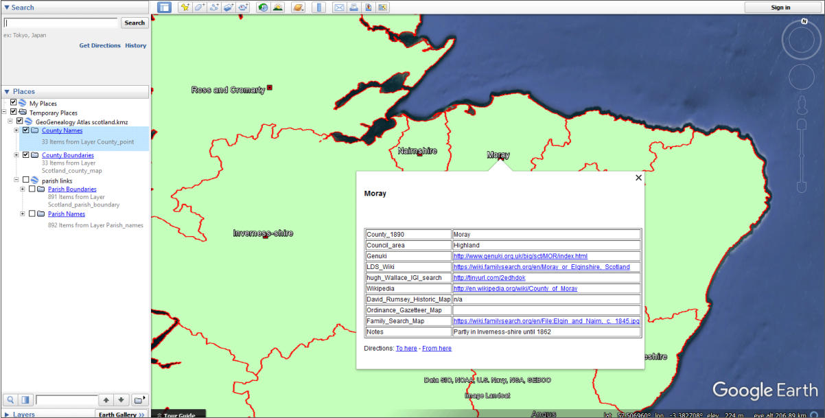
County names
If you click on the check mark in the left window beside the County name folder, a red square and
the county name will appear on the map. Click on the red square, for example in Moray, and a
pop-up menu will appear. Up to 7 fields are listed which link to external files. For example if we
select Genuki the Moray Genuki file will appear in the Google Earth interface. It it turn provides a
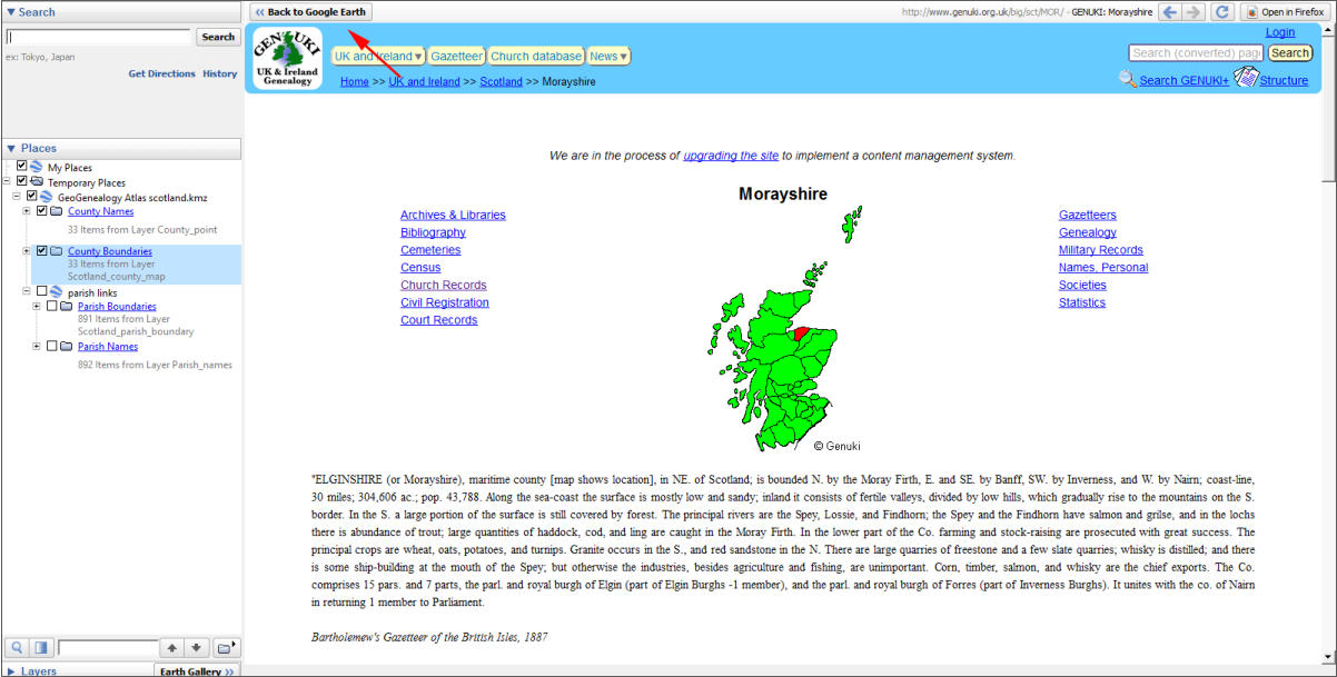
wide range of links relating to Moray Genealogy, for example;
Archives & Libraries
Bibliography
Cemeteries
Census
Church Records
Civil Registration
Court Records
Each of the above links can in turn be viewed in the Google Earth
window. Most of the Counties
also have links to either Rumsey
Historic, or Family Search maps. These maps can be viewed in the
Google Earth window but are not linked to the Google Earth
interface. If you wish to view a link outside of Google Earth right
click on a link in the drop down menu, copy and paste the link into
your browser.
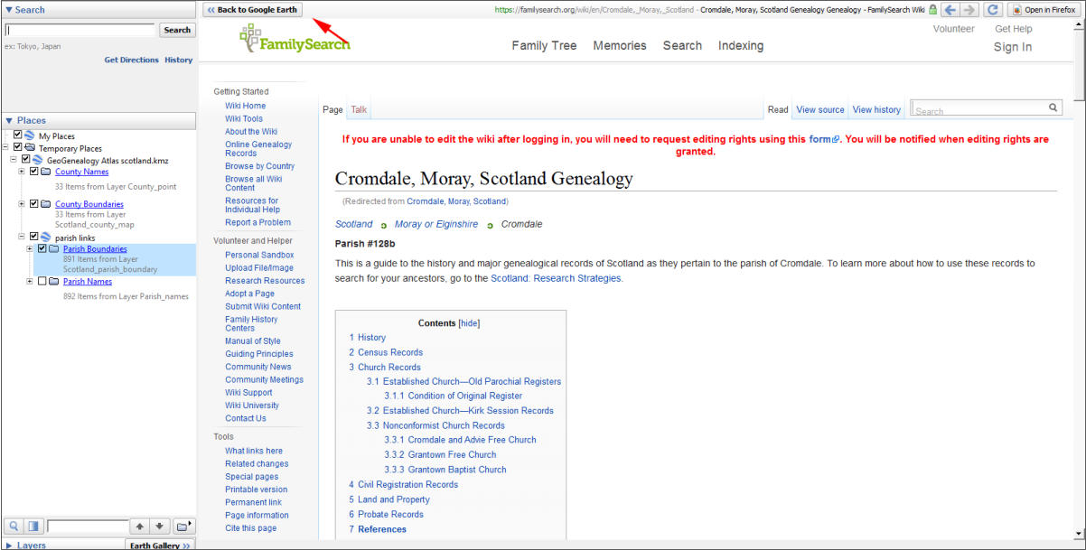
To return to Google Earth click the “back to Google Earth” link in the upper left hand corner.
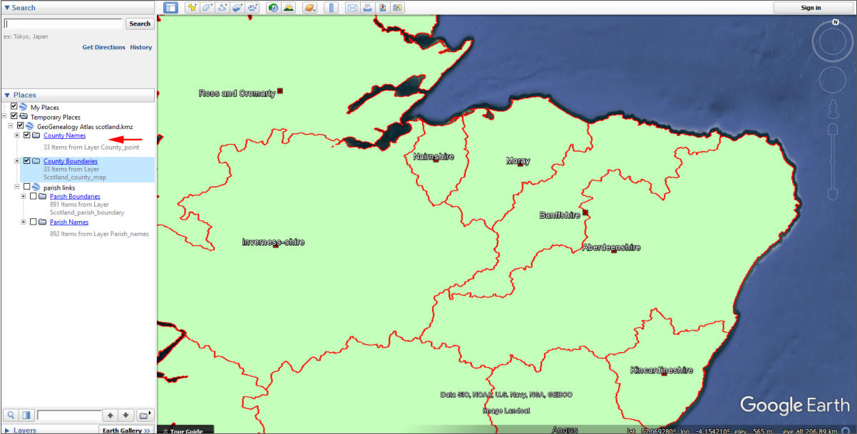
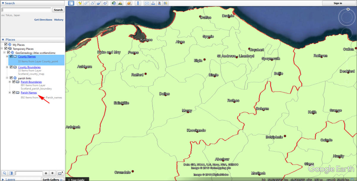
County Boundaries
If the Parish Name and Boundary files are unchecked, clicking anywhere within a county will bring
up the same menu as the red square.
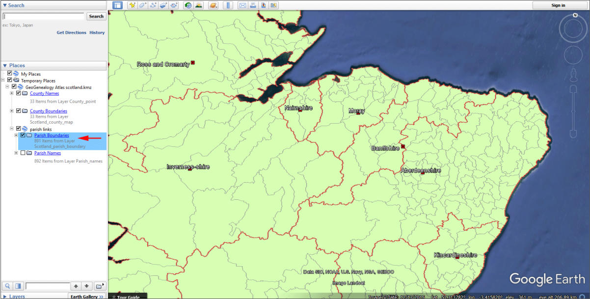
Parish Boundaries
891 individual parish boundaries are provided in the Atlas. Checking
the Parish Boundary file in the left panel will display the parish
boundaries within each county. Clicking your mouse anywhere
within a parish boundary will open the drop down menu for that
parish. The menu provides the name of the parish, the 1890 county,
and links to the LDS Wiki and Genuki sites. Selecting a link from the
parish drop-down menu will display that web page within the Google
Earth viewer. For example Clicking with the Cromdale Morayshire
boundary, will call up the drop down menu for Cromdale . If we then
select the Cromdale LDS link that web page will appear in the
Google Earth window. To return to Google Earth, select the Back to
Google Earth link in the upper left hand corner.
Parish names
Use the parish names file when you zoom in on a county or area.
Checking the parish names file will display all the parish names. It is
best to use this feature when zoomed in as the names will be
crowded if viewed at the national scale.