© J.H.Mathieson


The Border Reiver Toolkit
The Border Reiver Tool Kit is a series of Google Earth PRO files
of interest to researchers with Reiver or Border ancestors.
Google Earth Pro and the files are freely available for non
commercial use. The resources include:
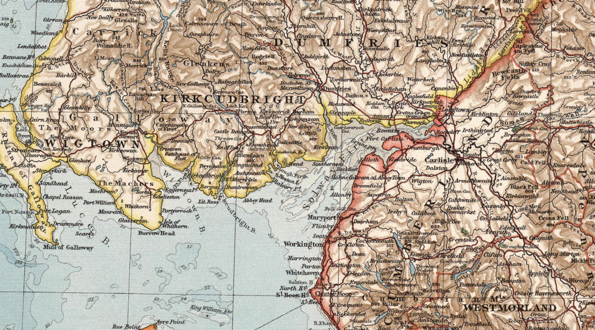
An Historic Overlay:
An historic 19th century overlay is accurately geo-referenced to
the border region. It illustrates the urban settlement pattern,
road networks and topography.
Download and save the geo-referenced tiff file to a directory of
your choice. From within Google Earth Pro use the File/Import
function to open the file. Go to the directory where you saved
the file. Under file type select GeoTiff(*.tif) and the file will
appear in your directory. Click on the file to open and you will
be prompet to “scale” or “create super overlay”. The super
overlay will allow you to zoom in for additional clarity of the
map features. If you select “super overlay” you will be prompted
to select a directory “where the super layer hierarchy can be saved”. I recommend the
same directory where you saved the overlay file. Once the overlay is drawn you can
then save it and other files to “my files folder” for easy future access.
Boundary files:
The following boundary files are included.
•
A set of county boundaries for both Scotland and England
border counties. For convenience Scotland border files
are shown in blue, while English border files are shown in
red.
•
The English and Scottish march borders in which the border
Reivers were most active.
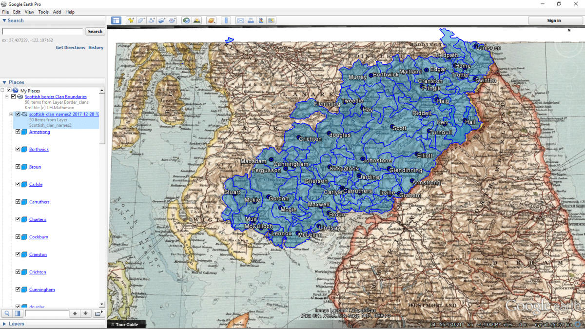
•
A set of clan boundaries found within the Scottish border
region. The clans are sorted alphabetically in the folders to
facilitate searches.
•
A set of 459 English parishes boundaries found within the border region. A
separate “parish names” file is included. This file can be toggled on or off to see
the parish names. The name file should only be used when zoomed in to a
specific area.
•
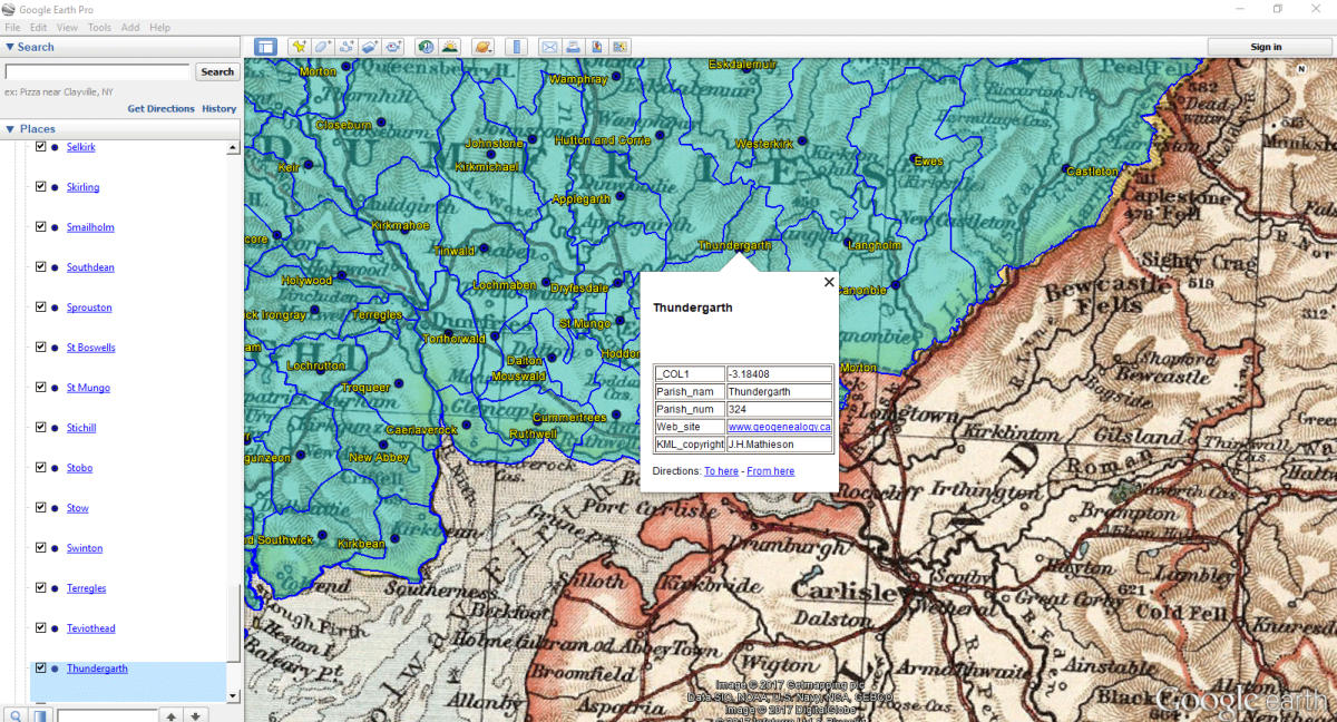
A set of 157 Scottish parish boundaries found within the
border region. The information includes the name and
area of each parish. A separate “parish names” file is
included. This parishes are listed alphabetically and can
be toggled on or off to find the location of specific
parishes. It should only be used when zoomed in to a specific area.
•
A set of 170 English Castle locations. Each feature includes the structure name
and alternate name if used. Additionally the Civil parish, historic county and
modern authority are noted. The type of structure, state of remains and
confidence in the listing of the site are included.
•
A set of 219 English Peel tower locations. Each location includes the structure
name and alternate name if used. Additionally the Civil parish, historic county
and modern authority are noted. The type of structure, state of it’s remains, and
confidence in the listing of the site are included.
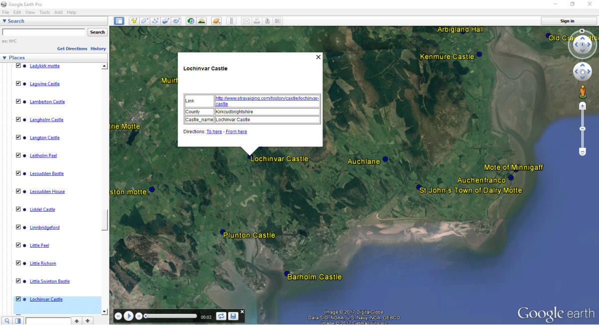
•
A set of 149 Scottish Castle locations found within the
Scottish borders. Each location includes the name of the
castle or its remains, the county in which it is found, and
a link to the Stravaiging website which provides links to
additional map services including Bing Google and National
Library of Scotland historic overlays and photos of the castles.
•
A set of 198 Scottish Towers located within the Scottish borders. Each location
includes the name of the castle or its remains and the county in which it is
found. A link to the Stravaiging website provides a brief history of each feature
and photos of the structure or remains.
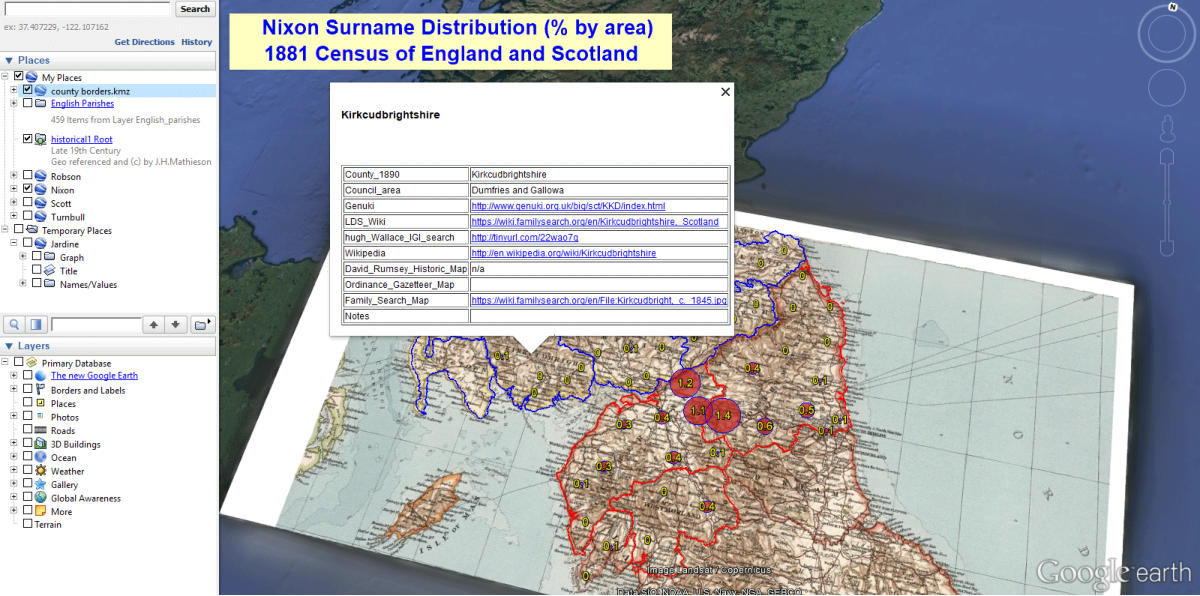
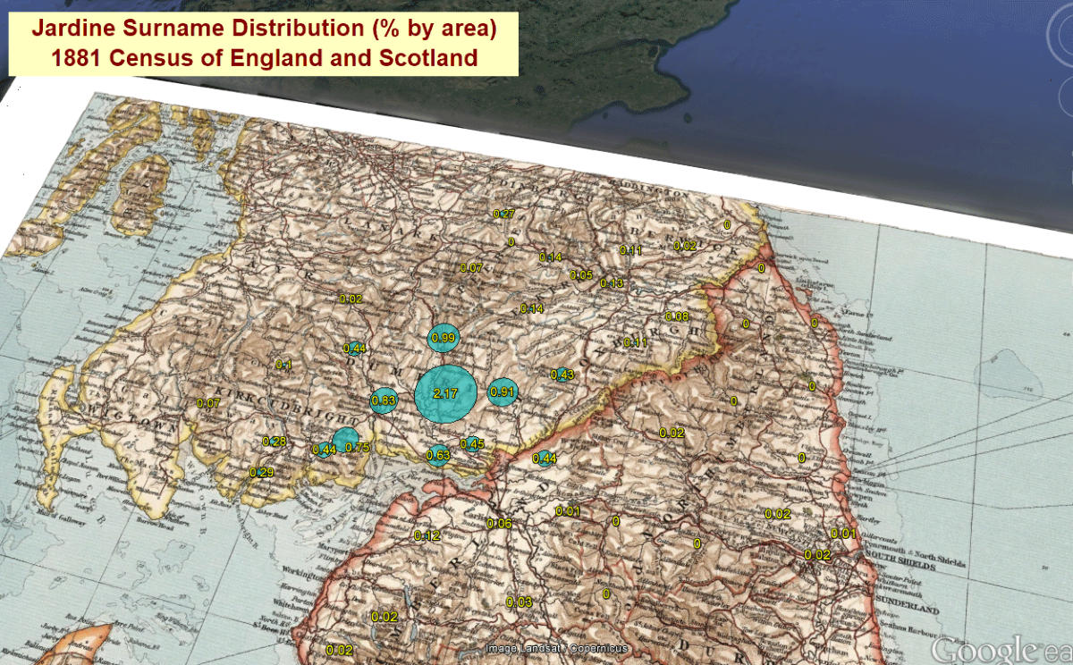
Border Surnames:
Distributions of the major border surnames can also be
downloaded. Each surname is calculated as a percent of the
total population in its area. Surnames which predominate on
the Scottish side of the border are shaded in blue, those on the
English side are shaded in red.
additional names will be added in the future.

Click Images to enlarge