

© J.H.Mathieson
The Ulster Surname Atlas
The Surname Atlas combines the Census to Parish Link Utility with your surname and or it’s variants in a desktop module.What’s Included?
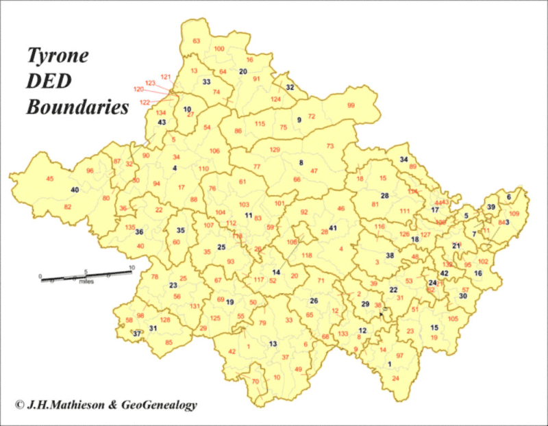
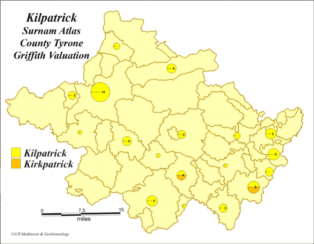
• 9 county 1901 Census maps of your surname each mapped at the DED level. Each county map has a corresponding map key which can be used to identify the Parish and DED each record is located. • The Census to Parish Link Utility with Parish and District Electoral Division boundaries and corresponding map keys. • 9 county Griffith Valuation maps of your surname mapped at the parish level with corresponding Parish map keys. • Master Excel files of the 1901 Census and the Griffith Valuation records with DED ##’s and Parish ##’s added to each individual record. This allows you to find the precise location of any Census or Griffith Valuation record. • The maps and tables are compiled in a a desktop module.Note:
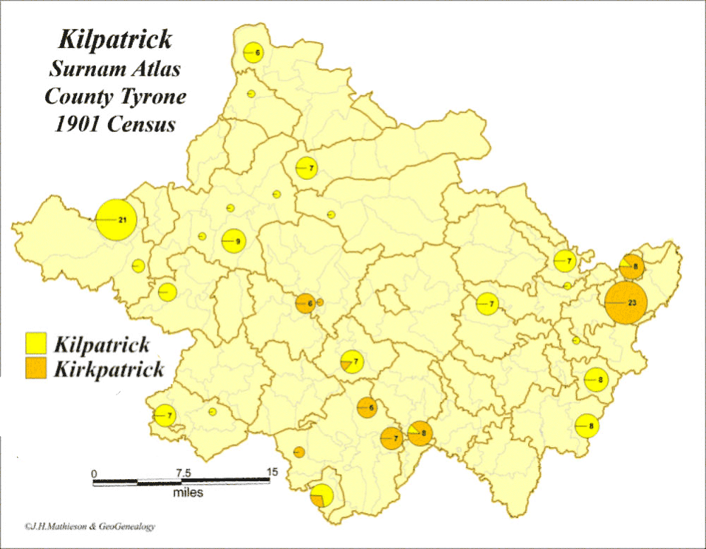
If you are beginning your Ulster research the Surname Atlas is a logical starting point. The Atlas allows you to link the 1901 Census with parish boundaries which are generally used in subsequent Ulster records. An Example: The Kilpatrick/Kirkpatrick Surname Atlas.