


© J.H.Mathieson


Instructions
The Census to Parish link Utility (CPLU) is a tool that locates each of Ulster’s 1,192 District Electoral Divisions in 419 Civil Parishes.The 1901 census
The 1901 census is the most comprehensive set of records available for 19th century Ulster researchers. However there is a problem. The census uses the District Electoral Division (DED) as its geographic unit, while most Ulster records like the 19th century Griffith Valuation, use the Civil Parish. The problem is further complicated by several issues. • Maps of DED’s are not readily available. • While some DED’s can be recognized by their names, the the vast majority use nomenclature unfamiliar to all but the most seasoned Ulster researcher. Therefore it is usually not possible to correlate the two geographic units.The Census to Parish Link Utility
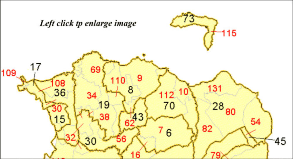
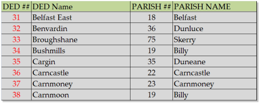
The CPLU is designed to map Ulster’s DED’s and to locate them in the Civil Parish where they are found. An example of the mapping technique can be illustrated with the map to the right. Parishes are numbered in black, the DED’s are numbered in red. • The names of DED’s and Civil Parishes can be identified from the Civil Parish or DED keys provided for each county . For example we learn that Civil Parish # 19 in County Antrim is Billy. Within the parish we find three DED’s, 34, (Bushmills) 38, (Carnmoon) and 69, (Dunseverick, not shown). • • As DED’s are more numerous than Civil Parishes, generally you will find multiple DED’s in each Civil Parish. The situation is complicated by the fact that portions of a DED may be found in adjacent parishes. In fact portions of a DED may be found in several adjacent parishes! • Referencing the map shown above, portions of DED number 110 are found in Parishes 8 and 19, while DED number 32, (Benvardin) is split between Parishes 36, (Dunluce), 30 (Derrykeighan), 13 ( Ballymoney) and 19 (Billy). • The number of a DED is located in the Parish where it is predominantly found, and a red line links the location of smaller portions of the DED in adjacent Parish’s.Application: Locating a Census Record
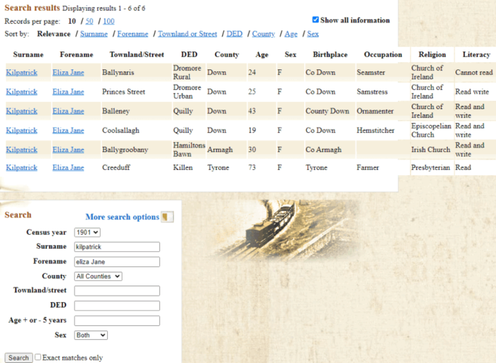
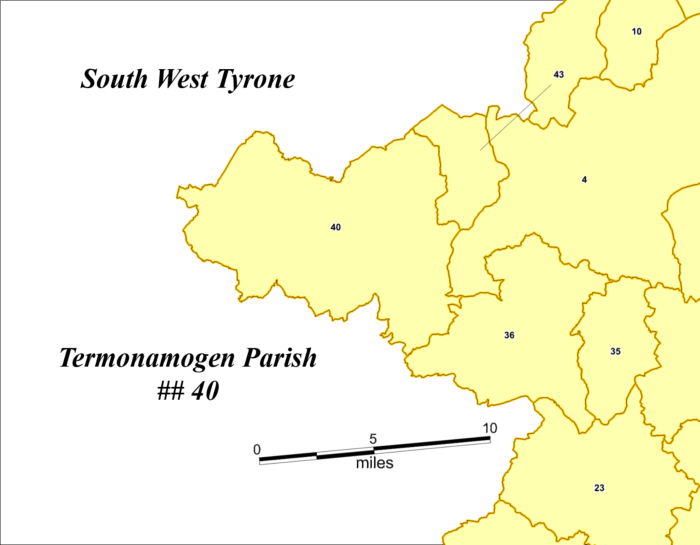
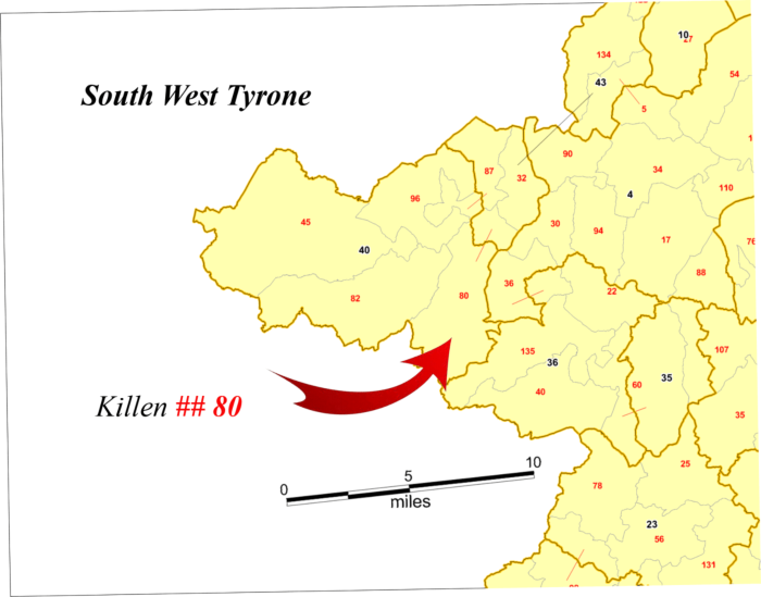
You are looking for an ancestor Eliza Jane Kilpatrick, the sister of your Great Grandfather who emigrated from Ulster to America immediately following the Great Famine. A family Bible tells you he had a sister born in 1831. Family lore says your Great Grandfather may have been born in County Tyrone. A search of the 1901 census for Eliza Jane Kilpatrick returns the following individuals: Of those listed, Eliza Jane found in Killeen in County Tyrone might be a possibility. She is 73 years old which would be close to her age listed in the Bible. Consulting the DED key for County Tyrone we find that DED Killen is #80, and is found in Parish # 40, Termonamongan. We can then consult the parish map for Tyrone to locate parish Parish # 40, Termonamongan, which is found in the far west of County Tyrone. Looking at the DED map we find Killen (80) in the South east corner of Termonamongan with a small section in the Parish of Urney(43).Locating a District Electoral Division
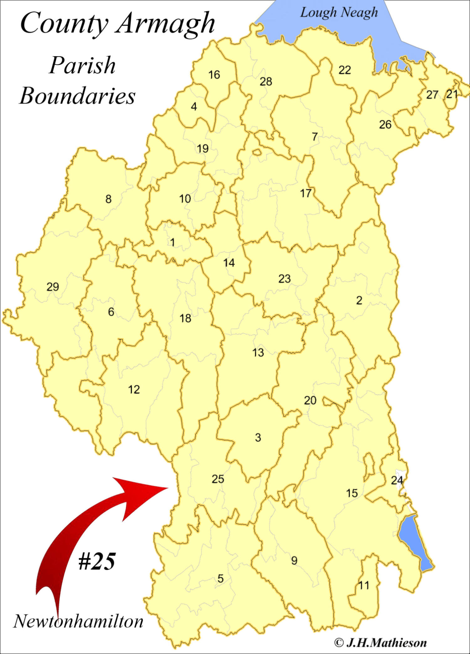
If you want to simply locate a DED and your know the County, select the county from the county menu and search the DED key. Take for example Camly, a DED located in County Down. Referencing the alphabetical DED key for County Down we find Camly is DED #16 in Newtonhamilton Parish #25. If you don’t know the County, search the master CPLU Excel file* for a DED. The master CPLU key provides the Civil parish ##, the DED ## and County in which a DED if found. Then reference the parish and DED maps. *(provided with the CPLU program)Note:
In this version of the program portions of the CPLU map keys have been omitted. Once purchased the keys are fully activated.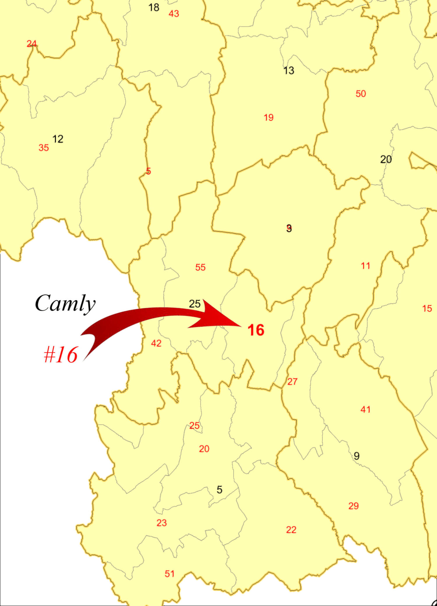


The Census to Parish Link Utility