Scottish Origins
(Map viewing tips)
Population and by extension, surname distributions, are
the product of historic, economic, cultural and
biological processes.
Failing the impact of dramatic events, once established
in a region, a surname will tend to remain and intensify.
This is not to say a surname cannot undergo change. In
the 18th century the inexorable shift from rural areas to
the urban metropolis began, and during the 19th
century this process accelerated as railways began to
reshape the landscape. Consequently the shift of
population to urban areas has tended to obscure the
essential origin and stability of surname distributions.
A first task will be to identify those areas which have
long term roots which may be under represented by
19th century surname distributions.
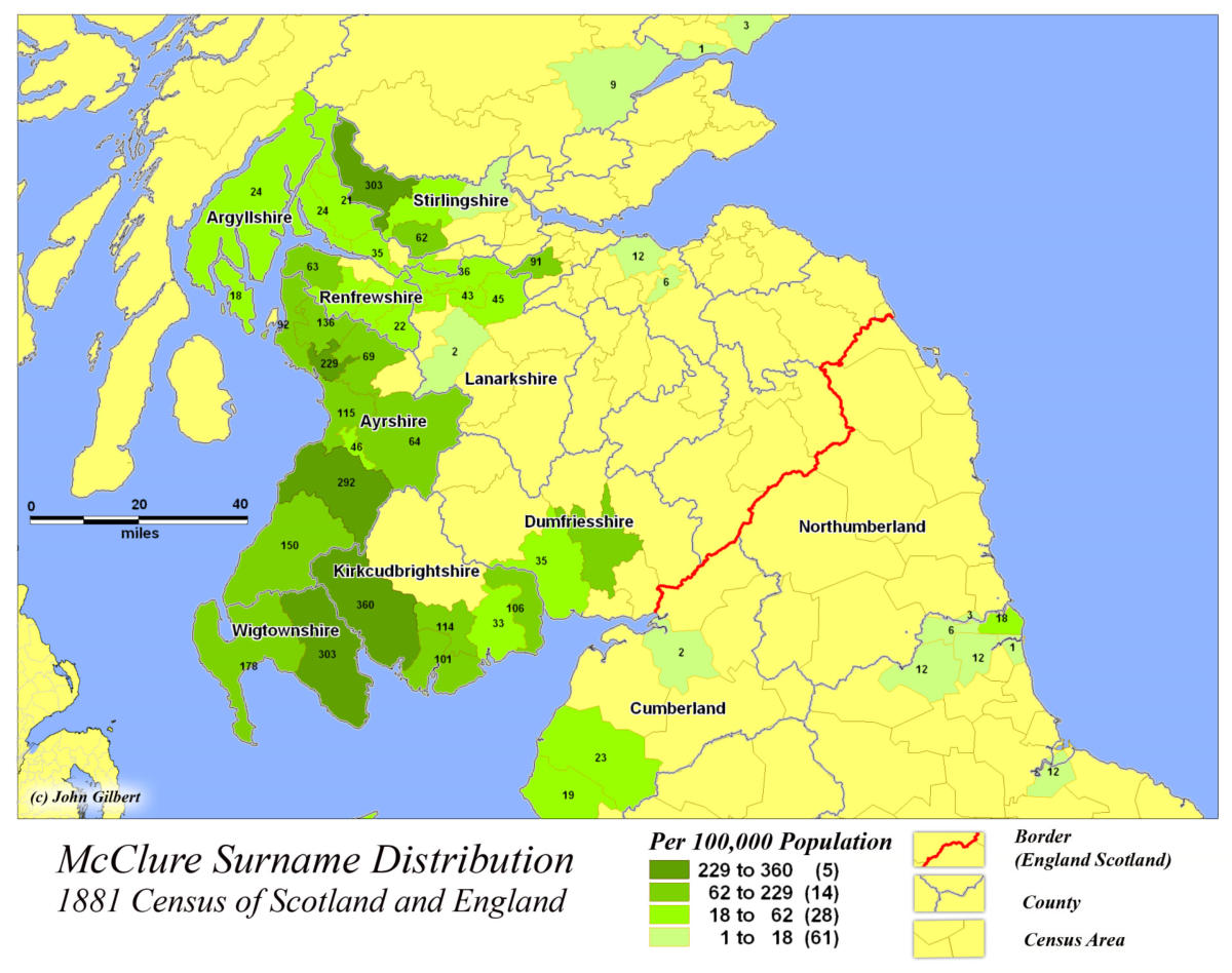
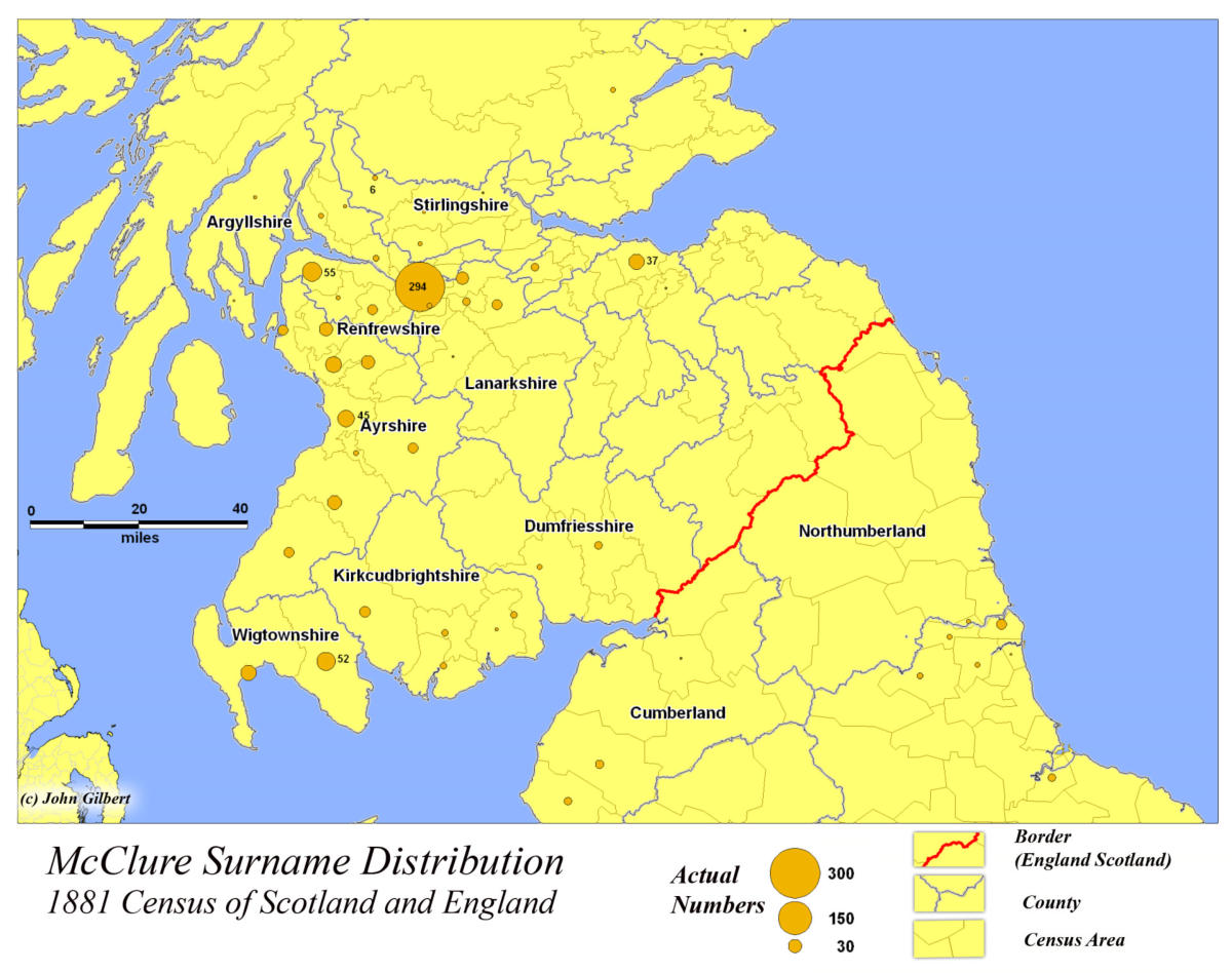
The 1881 Census The Scottish census of 1881 provides us with an detailed picture of the McClure surname distribution at the end of the 19th century and can be used as the starting point for our analysis.As noted previously by Black et al, the McClure
surname is focused in the east coastal Lowlands.
However the 1881 census identifies the Glasgow
metropolitan region as the region with the greatest
number of McClure’s. This is not unexpected
considering that by the late 19th century Glasgow was
the industrial heartland of Scotland.
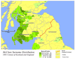
To eliminate the distortion of the Glasgow metropolitan
region, we will use a “relative” index. We can measure
the population in each census area per 100,000
population. Standardizing the distribution in this way
shifts the focus away from Glasgow to central Ayrshire
and to Galloway (Wigtownshire and Kirkbrightshire).
This is much more consistent with the Etymology
outlined by Black, MacLysaght and Bell.
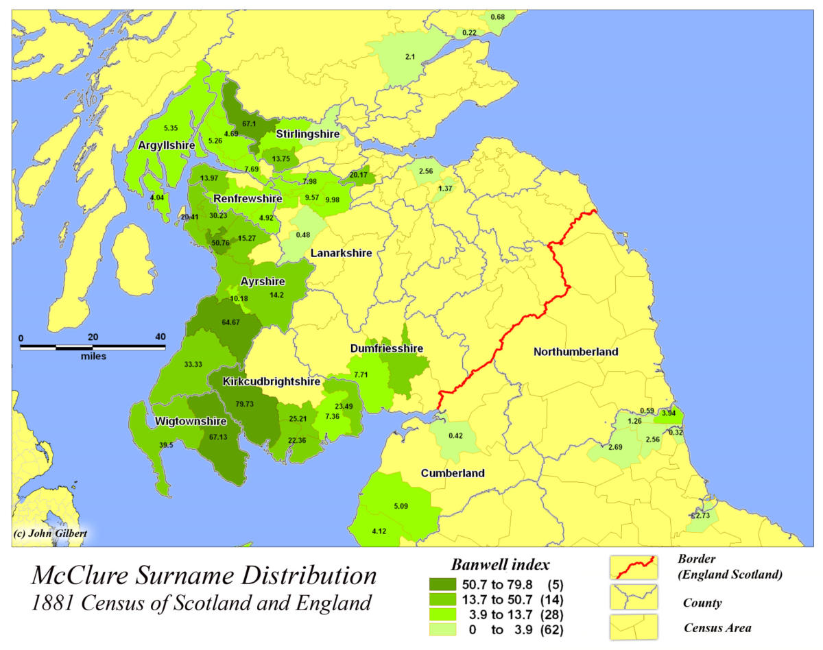
One further measure can be used to identify the
McClure surnames intensity. We can compare the local
distribution with the national distribution using the
“Banwell index.” With this index a value of 5 means the
population is 5 times as concentrated in the local area
when compared with the national distribution. This
approach emphasizes Galloway and central Ayrshire
where the surname is almost 80 times the National
Average.
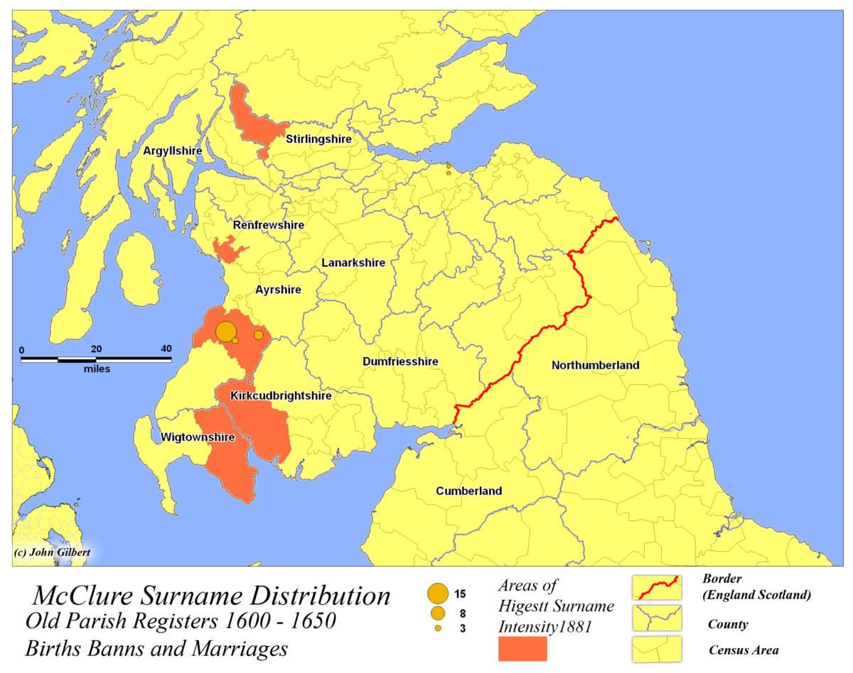
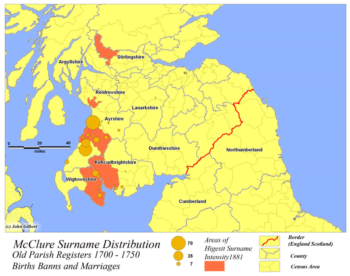
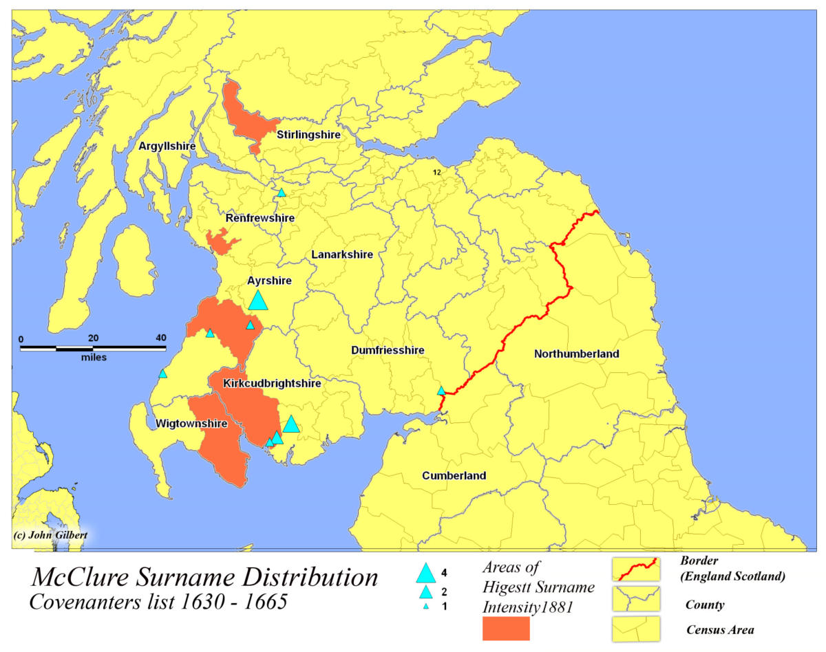
Surname PersistenceTo Identify the persistence of the McClure surname,
records from the past are compared with the 1881
census. Old Parish records, (Births and Marriages), can
be compared with the regions of highest intensity. In
this instance records covering the period 1600 - 1750 are
broken into 50 year cohorts. The persistence of the
surname as far back as the 17th century is confirmed by
the old parish registers. The Covenanter list provides an
additional confirmation of the surnames presence in the
SW lowlands. Between 1633 and 1655 24 McClures
signed the Covenant, the majority in the South West
Core.
Conclusion:Surname authorities, Black and Bell, identify
Wigtownshire and Ayrshire as the historic home of the
McClure surname. It appears to have been well
established in the region by the 16th century, as
evidenced by Blacks exemplars and the old parish
records.
Importantly it is clear, at least in this case, that the 19th
century distributions adjusted for urbanization are
reliable predictors of the Scottish homeland of the
“Scots Irish”.
Their migration to the new world in the 17th and 18th
century began by first crossing the narrow sea between
Ulster and the Scottish Lowlands from Wigtownshire
and Ayrshire.
Return to top
© John Gilbert
Created by SurnameOrigins


McClure
Surname Origins