

The Kilpatrick Surname Study


© Holly Kilpatrick


The Kilpatrick Surname Study
GeoGenealogy
The large scale settlement of County Antrim was preceded by the confluence of
several important political and economic events. First, the end of the Seven
Years' War left England in control of Ireland. Second, the ascension of James IV
to the crown of both Scotland and England as James I, also becoming the King of
Ireland, had significant implications. Finally, the flight of the Earls and 90 of
their supporters left a political vacuum that Scottish and English landlords were
anxious to fill,,,,
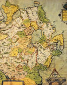
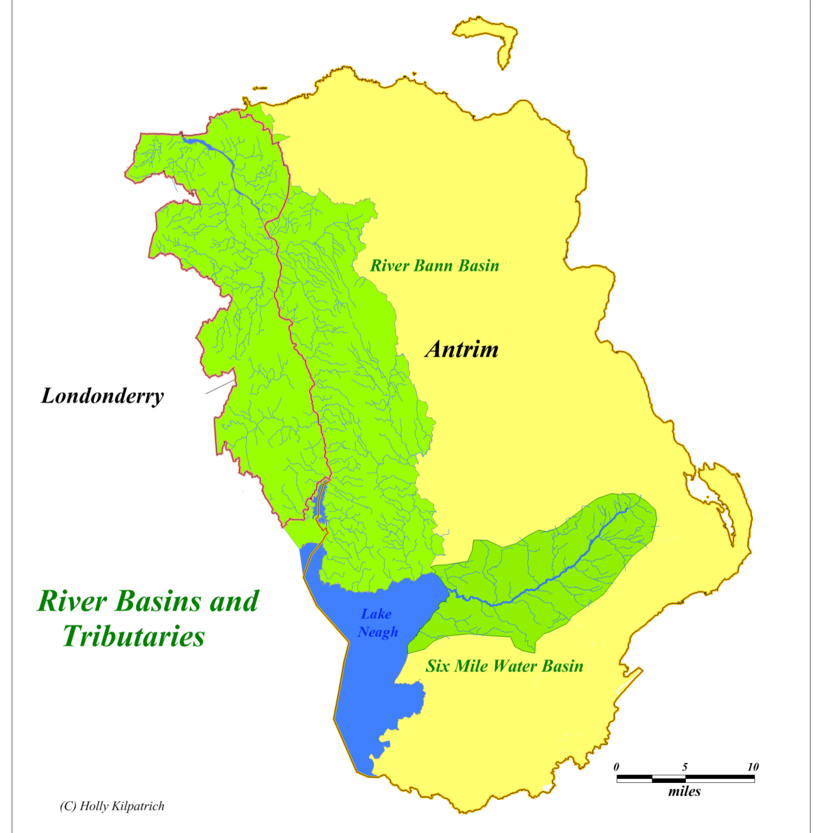
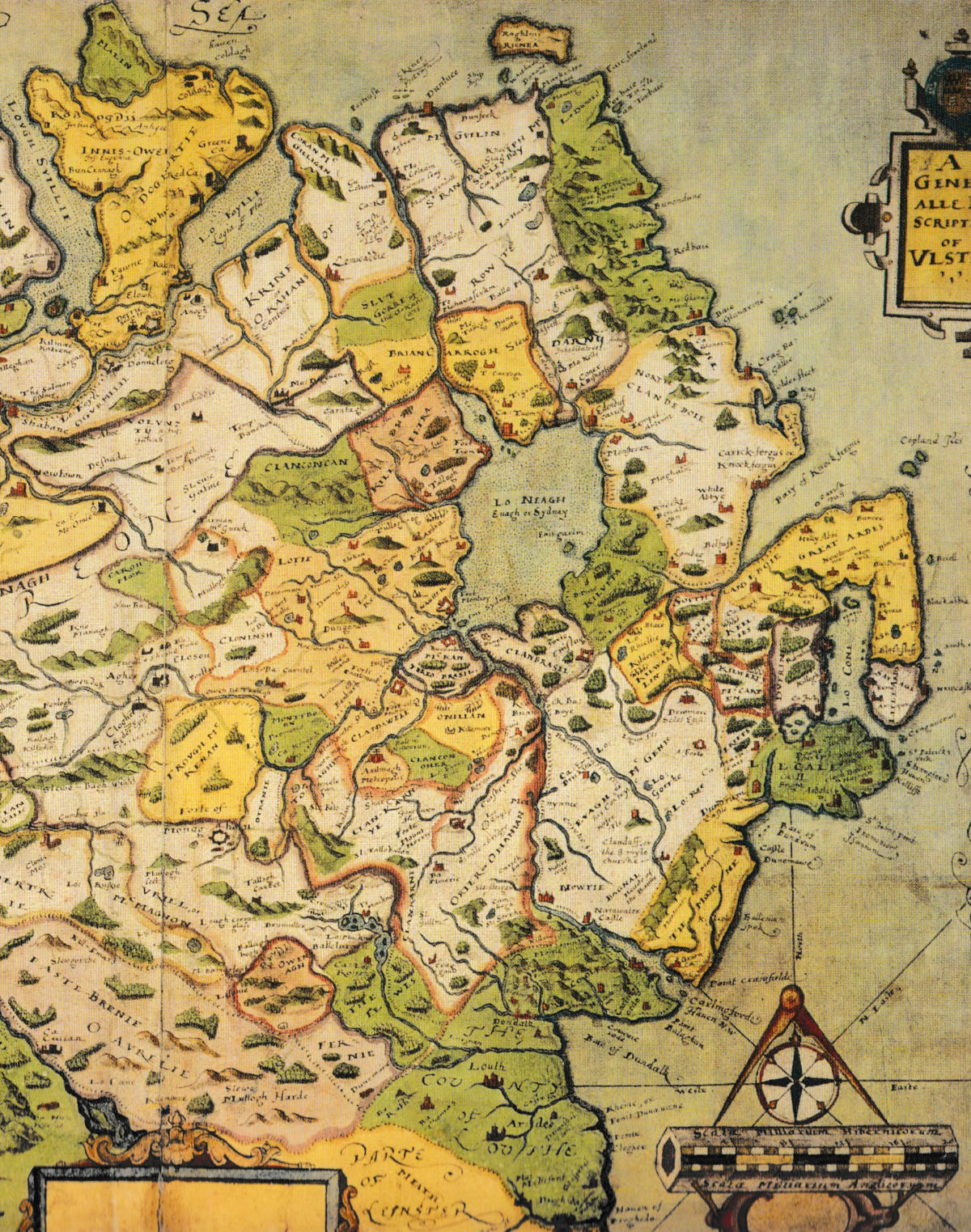
The Settlement of County Antrim
A thorough comprehension of County Antrim was lacking due
to the absence of clear geographic boundaries stemming from
traditional landholding practices and the scarcity of detailed
maps. This uncertainty in the landscape influenced settlement
patterns, which were often guided by features like rivers and
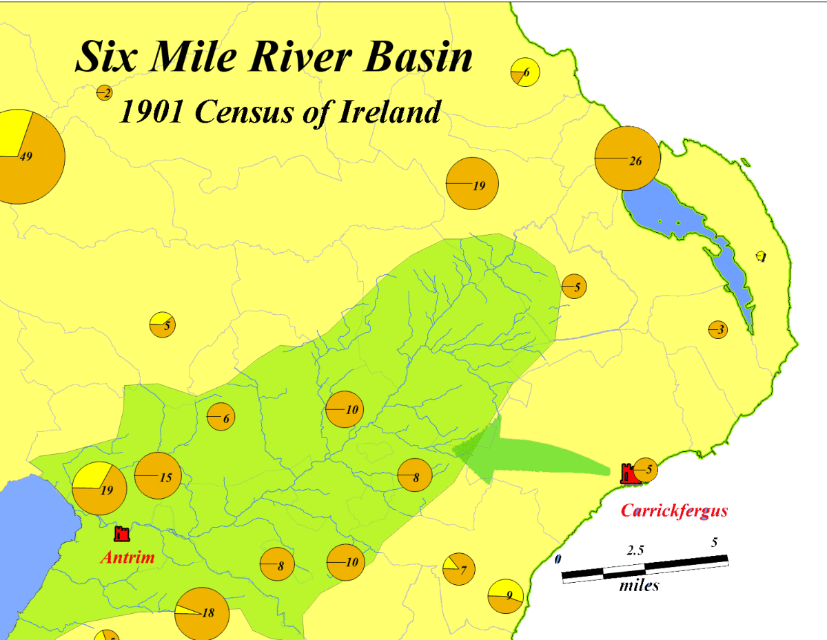
their tributaries. Particularly, the River Bann and Six Mile Water
were instrumental in enabling access and facilitating movement,
thus defining migration routes and settlement sites throughout Antrim.
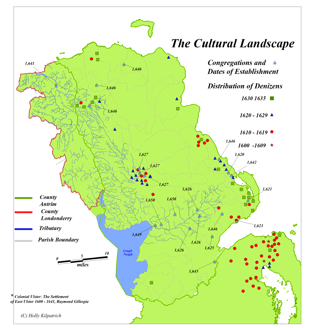
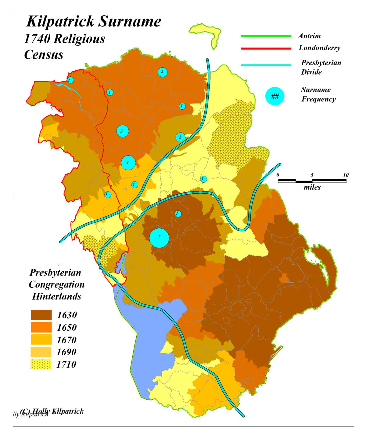
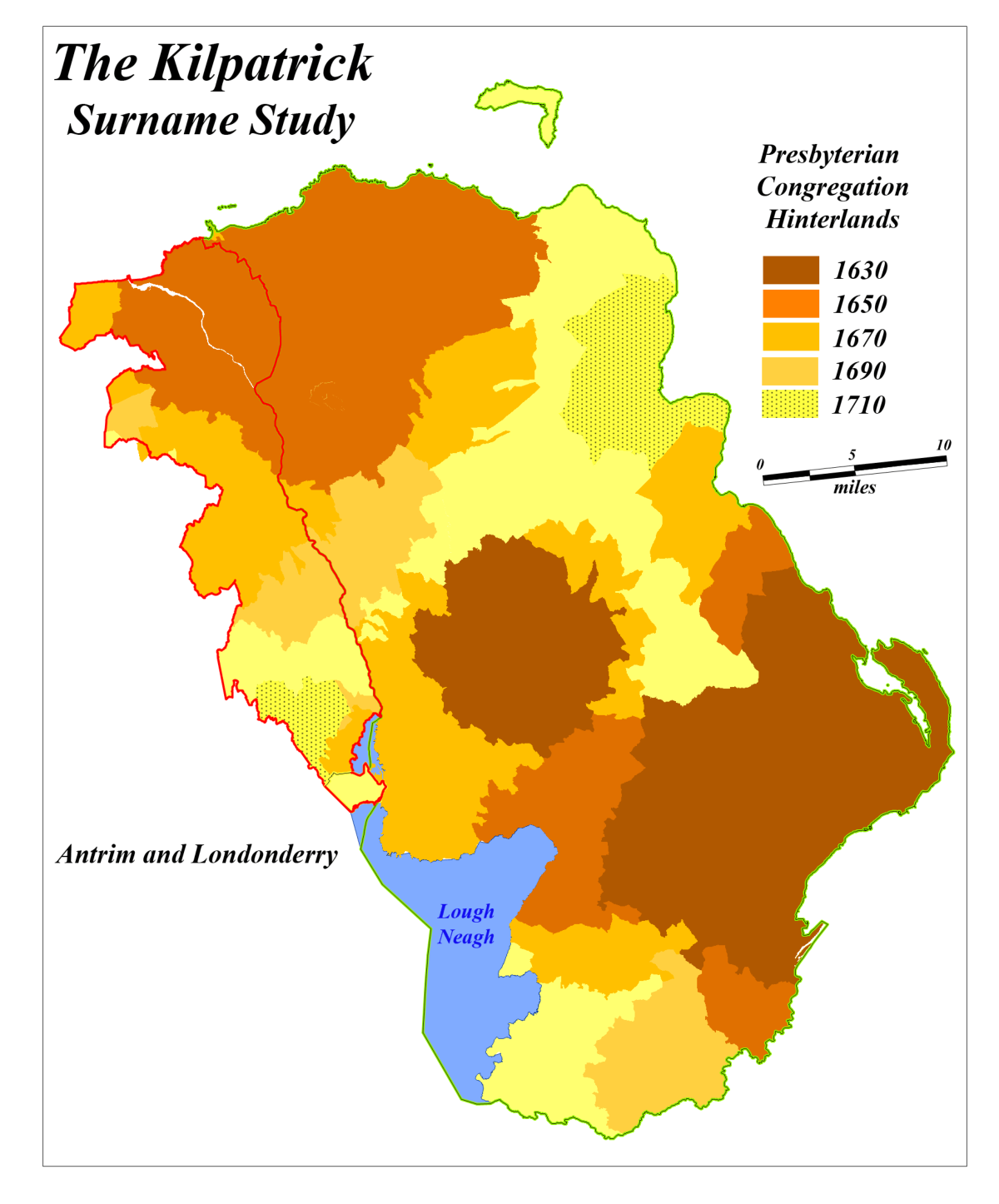
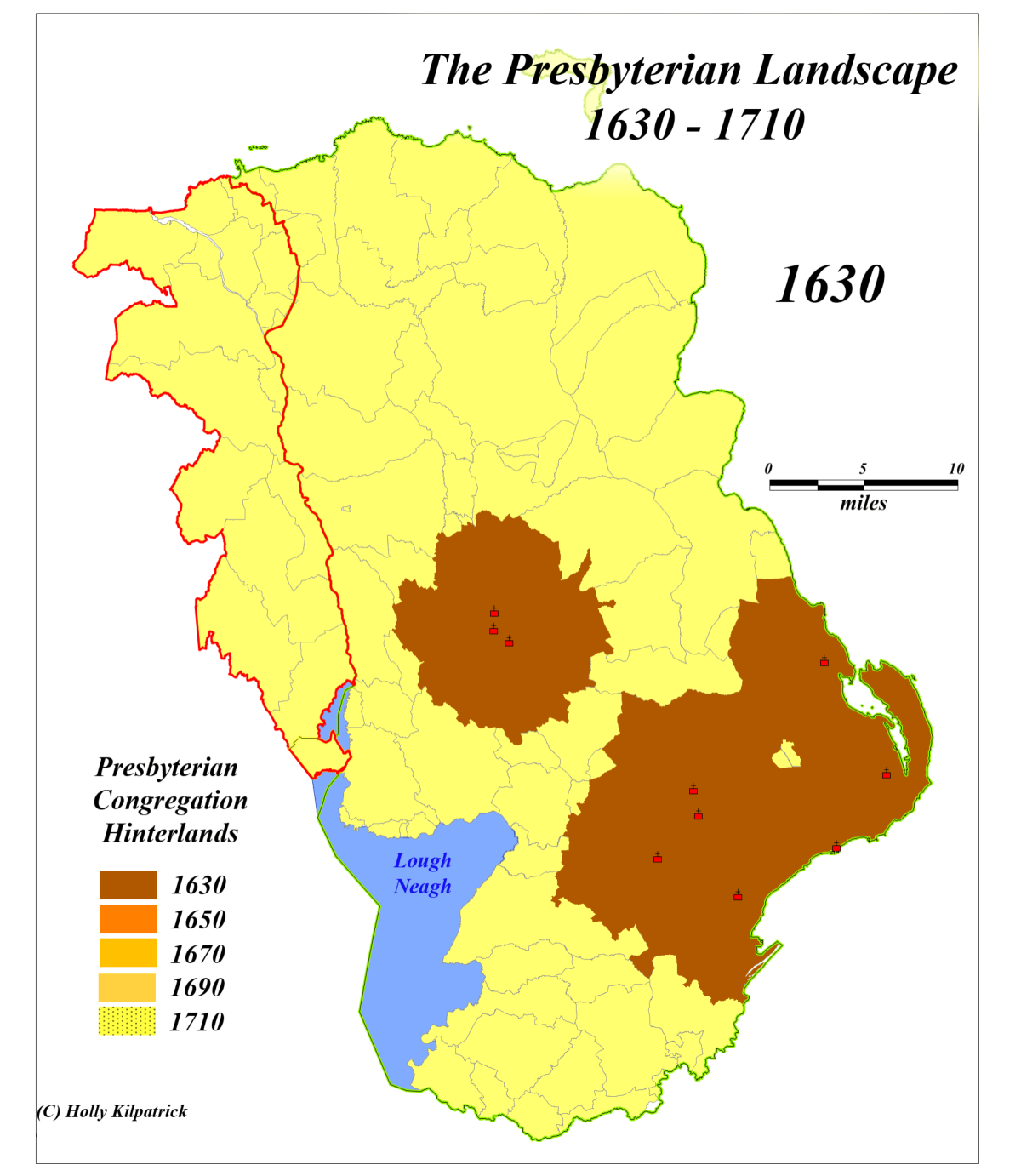
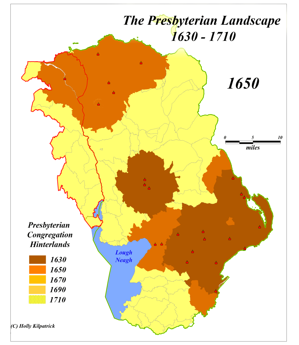
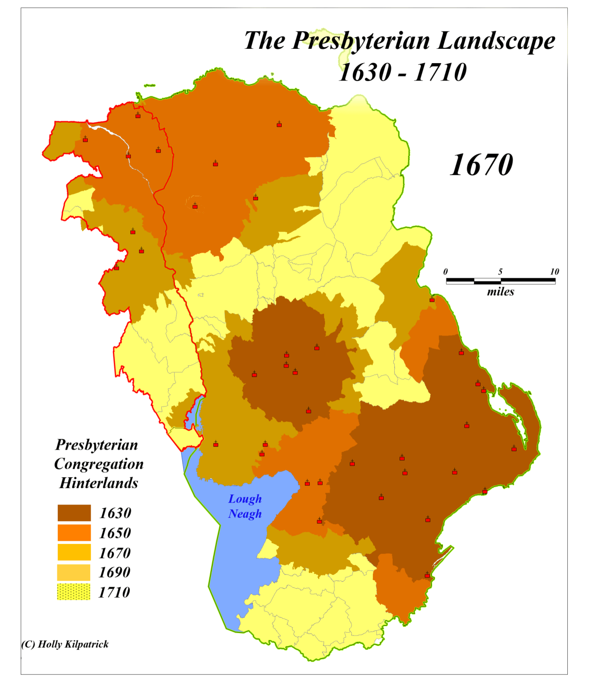
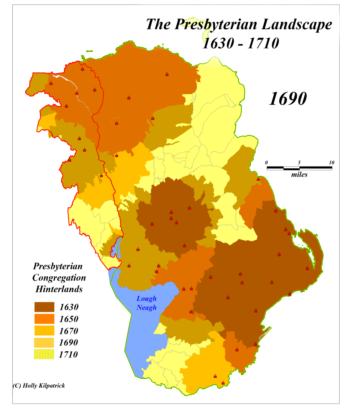
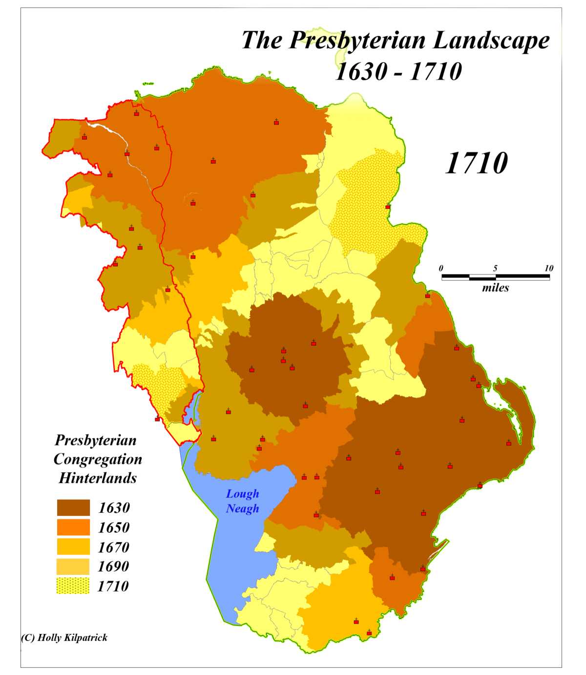
The Expansion of Presbyterianism
The Presbyterian faith, brought by migrants, played a significant role in the
establishment of communities. The presence of Presbyterian meeting houses,
which required a population base to support, serves as an indicator of settlement.
In a study conducted by the author, it was demonstrated that Presbyterianism
entered Antrim through independent channels from both the north and the
south. Through mapping the locations of these meeting houses and examining
their distribution over time, we can reconstruct the Presbyterian landscape of
Antrim from 1600 to 1710. The distribution of Denizens during this period
supoorts this analysis.
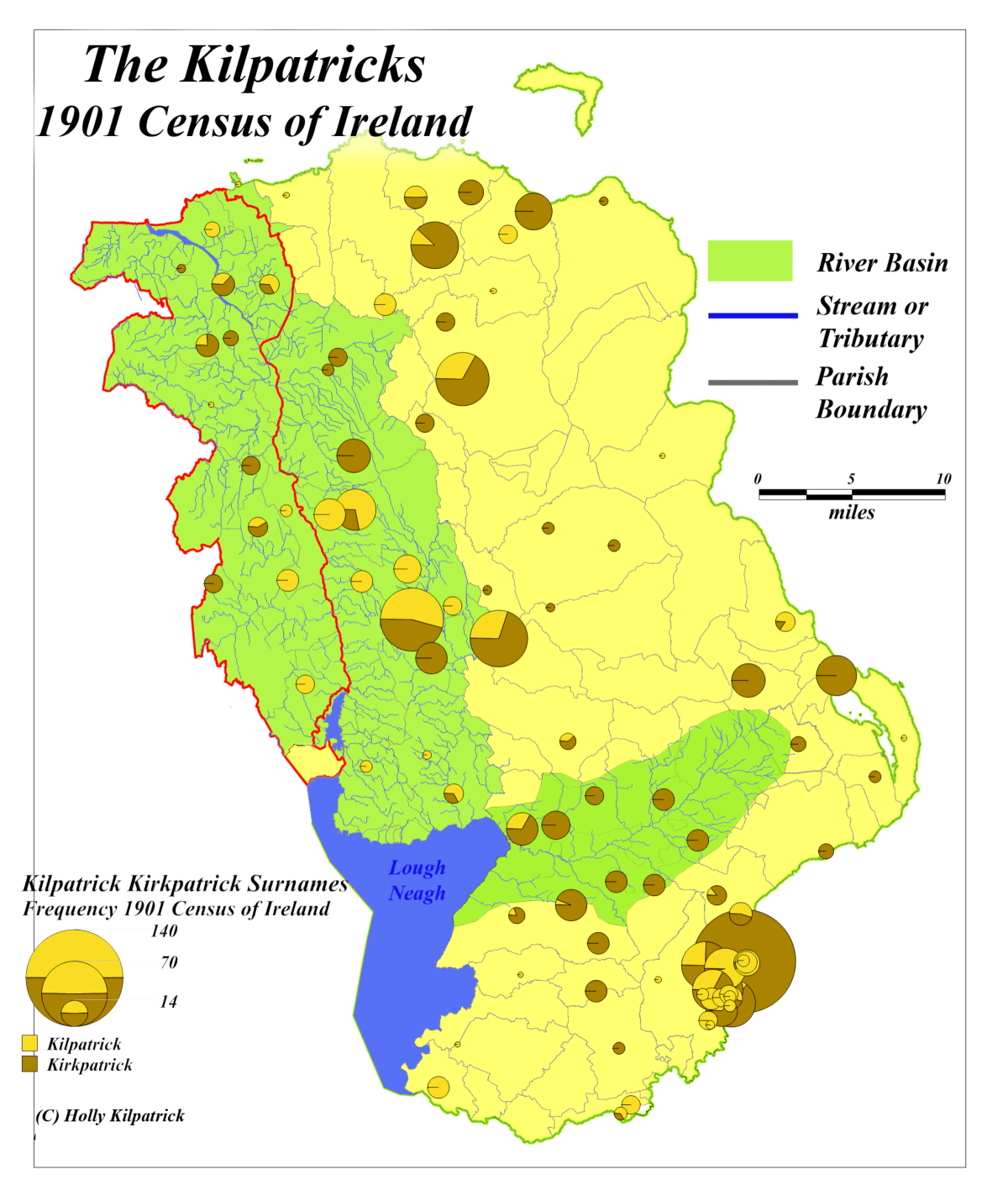
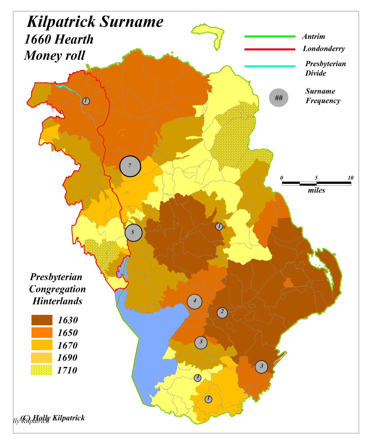
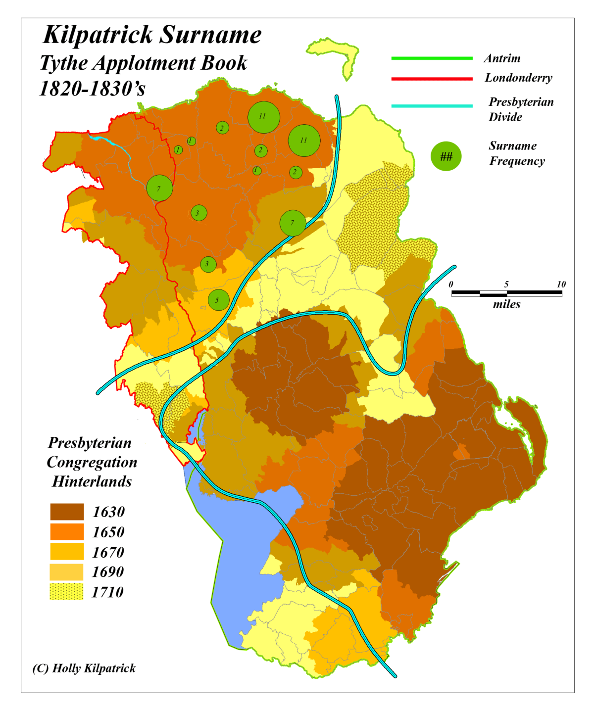
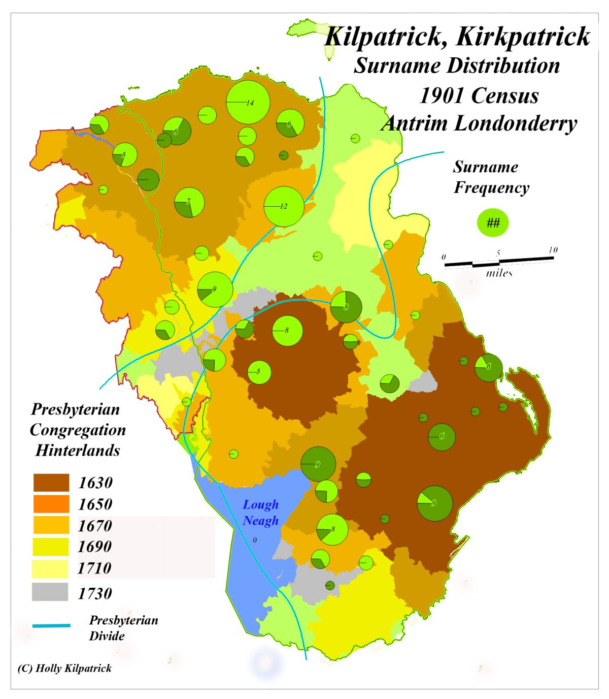
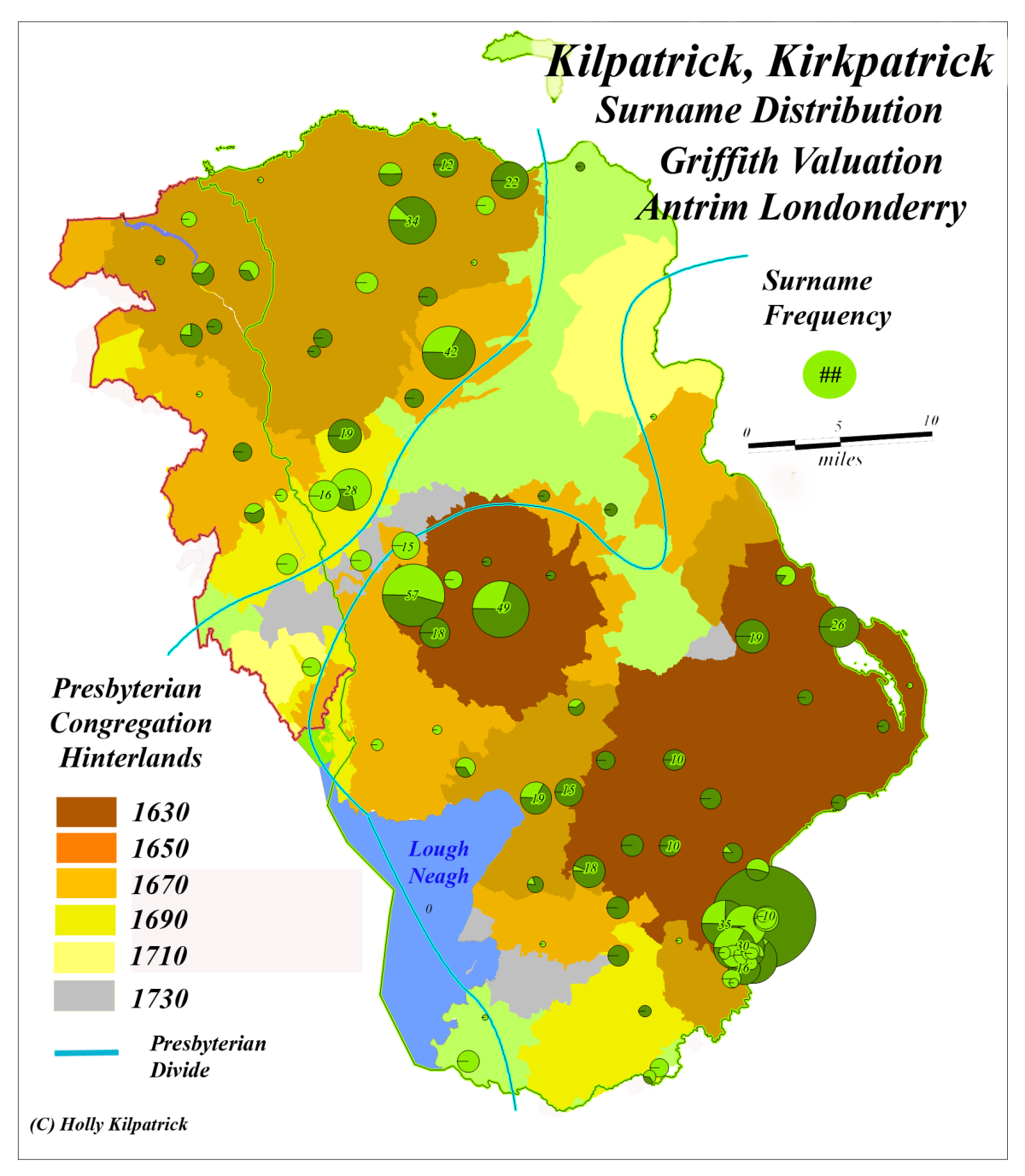
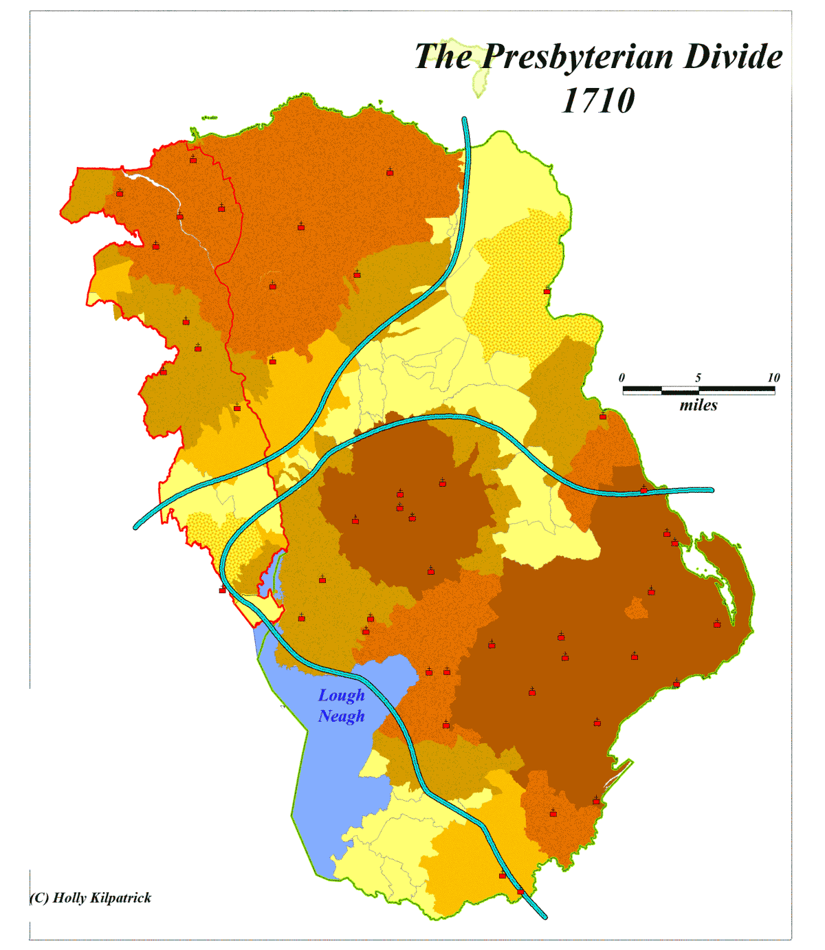
The Kilpatricks and the Presbyterian Landscape
The geographic overlap between Presbyterian settlement patterns and the
concentration ofthe Kilpatrick/Kirkpatrick surname in the regions surrounding
the River Bann and Six Mile Water basins implies a meaningful spatial
association. This alignment is substantiated by the striking similarity observed
between contemporary distributions, as documented in records like the 1901
Census and Griffith Valuation, and the distribution of Presbyterians in 1710.
While specific historic records concerning the Kilpatricks are somewhat sparse,
they nonetheless provide sufficient evidence to indicate that the dispersal of the
surname were tied to broader migration trends. Various historical indices,
including Griffith Valuation, North Antrim Tithe, and 1740 religious returns, and
the Hearth Money Roll, highlight the connection between the Kilpatricks and
theevolution of the Presbyterian landscape.